“Weather + Hun Permitting!!!” – A Rare Artillery Spotter’s Sketch of the Notorious Passchendaele Ridge
This November, we’re spotlighting an extraordinary item from our stock which documents firsthand the Passchendaele battlefield from the point of view of a British Observation Officer.
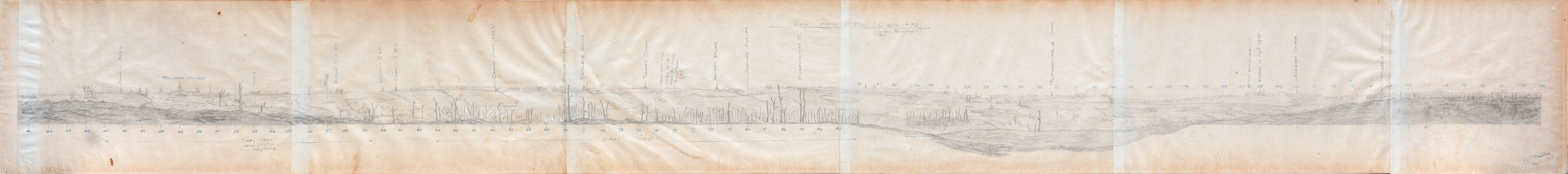
An enthralling and highly unusual survival from the Great War: a fine original artillery spotter’s panoramic sketch of the Passchendaele Ridge, north-east of Ypres – signed and dated “H. P. Manton, March 1918” – as viewed from a position at an Observation Post (“O. Pip”) on its lower slopes by a British Forward Observation Officer.
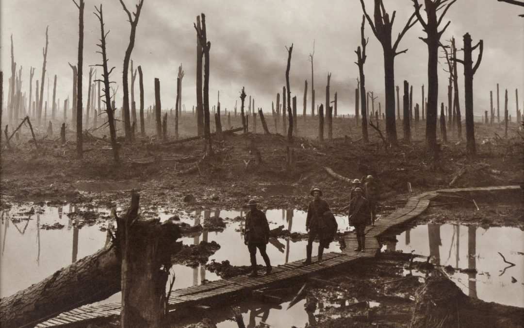
This skillfully sketched view across a section of the Western Front – with its the familiar mournful litany of torn and ragged tree stumps, earth ploughed by shellfire – shows a succession of landmarks: church spires, windmills, towns, and salient features carrying easily identifiable nicknames such as “Assyria” and “Rhine”, and the position of a trench mortar.
The major details of the landscape are “Dairy Wood”, “Daisy Wood” and “Table Wood” and the map is headed “View from D234. ” with the amusing sub-text “Weather + Hun Permitting!!!” The O.P. was just behind the British front line trenches as they stood at the conclusion of the battle of Passchendaele, the village itself having been taken but subsequently lost to German counter-attacks. This was a section of the Front occupied by the Australians during 1917 and the landmarks mentioned here featured in the Battle of Broodseinde (4 October 1917), fought near Ypres, at the east end of the Gheluvelt plateau; “Daisy Wood” in particular was a strongly held position.
The battle was deemed a striking success: Plumer, in charge of Second Army, describing it as “the greatest victory since the Marne” (quoted in Bean’s The Australian Imperial Force in France) – this was largely due to the startling gains made by the 3rd Australian Division. However, in March 1918, the date appended to the map, the Germans launched Operation Michael, their great spring offensive that threw the Allies on to the back foot.
The brunt of the initial assault fell to the south of Broodseinde but between 9 and 29 April the second phase of the German drive centred along this part of the line, in an attack known as the Lys Offensive, with the result that this sector changed hands for the fourth or fifth time during the war. Other features sketched here are a building, doubtless in ruins, on the road running east-west from “Beecham” (a German-built deep dug-out, captured and utilised by the British) and the north-south running Broodseinde-Niewmolen Road.
Henry Percy Manton (1894-1984), the officer responsible for this view, was born at Weymouth, Dorset, and educated at Imperial College, London. He initially served as a private with the 2nd County of London Yeomanry (Westminster Dragoons), before being commissioned in the Royal Garrison Artillery (Special Reserve) 5 March 1917 and promoted to lieutenant on 5 September 1918. He was still serving in 1919 but would have been demobilized around the end of that year. The title of the panorama, “View from D234”, suggests that Manton’s unit was D234 Battery, R.G.A., an eight-inch howitzer battery. After the war he lived at Retford, Nottinghamshire, and from early 1920 was a field manager with Lobitos Oilfields Ltd., based in Peru; he was also a member of the Geological Society of London.
It was essential for Forward Observation Officers, either new to Front Line work or in a new position, to study the physical features and locations in the target area of their unit. A proven method of familiarising oneself with the ground was to draw it, utilising sketching skills learned during officer training. In late 1916, David Jones, author of In Parenthesis, one of the major books of the Great War, was posted to an Observation Group attached to the Royal Engineers in the same sector of the front, described by Jones’s biographer Thomas Dilworth as “the extreme northern end of the British line and its area of most concentrated violence” (David Jones in the Great War, 2012, p. 132). Here he made sketches similar to that made by Manton.
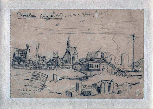
“Brielen, August 1917. Mark I or Mark IV tank,” by David Jones (1895-1974). The Royal Welch Fusiliers Museum / The David Jones Literary Estate via First World War Poetry Digital Archive.
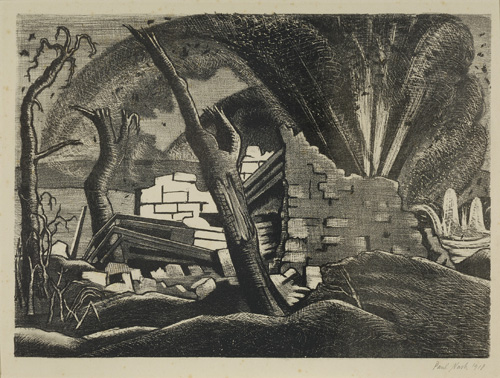
Another representation of the Battlefield at Passchendaele: Paul Nash (1889-1946) Shell Bursting, Paschendeale. © IWM (Art.IWM ART 1604)
Such surviving panoramas are rare in private hands; this particularly fine example – rendered at a critical juncture on the Western Front – was no doubt retained by the artist as a souvenir of his experiences on the infamous Passchendaele Ridge. It is a poignant pictorial record of real immediacy, capturing the archetypal image of a landscape likened by Jones to the wasteland of Malory’s “King Pellam’s Launde”, and described so memorably by him: “Very slowly the dissipating mist reveals saturate green-grey flats, and dark up-jutting things; and pollared boles by more than timely wood-craftsman’s cunning pruning dockt, – these weeping willows shorn”.
If you are interested in this item, please get in touch.
If you would like to make an enquiry about selling a book, please fill out the form which can be found here.
Recent Comments